


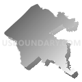
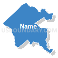
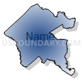
Orangeburg, Colleton, Barnwell, Hampton, Bamberg & Allendale Counties PUMA, South Carolina
About
Outline

Summary
| Unique Area Identifier | 193967 |
| Name | Orangeburg, Colleton, Barnwell, Hampton, Bamberg & Allendale Counties PUMA |
| State | South Carolina |
| Area (square miles) | 4,189.14 |
| Land Area (square miles) | 4,072.34 |
| Water Area (square miles) | 116.80 |
| % of Land Area | 97.21 |
| % of Water Area | 2.79 |
| Latitude of the Internal Point | 33.09795430 |
| Longtitude of the Internal Point | -80.97023940 |
Maps

Orangeburg, Colleton, Barnwell, Hampton, Bamberg & Allendale Counties PUMA in South Carolina
Download

Graphs
Select a template below for downloading or customizing gragh for Orangeburg, Colleton, Barnwell, Hampton, Bamberg & Allendale Counties PUMA, South Carolina


Neighbors
Neighoring Public Use Microdata Area (by Name) Neighboring Public Use Microdata Area on the Map
- Aiken & Edgefield Counties--Aiken & North Augusta Cities PUMA, SC
- Beaufort & Jasper Counties--Hilton Head Island, Bluffton Towns & Beaufort City PUMA, SC
- Central Savannah River Area Regional Commission (West & Outside Richmond & Columbia) PUMA, GA
- Charleston (Northeast) & Berkeley (North & East) Counties--Mount Pleasant Town PUMA, SC
- Charleston (South & West) & Berkeley (South) Counties--Charleston City PUMA, SC
- Charleston, Berkeley & Dorchester Counties--North Charleston City PUMA, SC
- Coastal Regional Commission (North)--Bulloch, Effingham & Screven Counties PUMA, GA
- Dorchester (North & West) & Berkeley (Southwest) Counties--Summerville Town & Ladson PUMA, SC
- Kershaw, Richland (South) & Calhoun Counties PUMA, SC
- Lexington (South & West) & Saluda Counties--Lexington Town & Red Bank PUMA, SC
- Sumter, Clarendon, Williamsburg & Lee Counties--Sumter City PUMA, SC
Top 10 Neighboring County (by Population) Neighboring County on the Map
- Charleston County, SC (350,209)
- Lexington County, SC (262,391)
- Berkeley County, SC (177,843)
- Beaufort County, SC (162,233)
- Aiken County, SC (160,099)
- Dorchester County, SC (136,555)
- Orangeburg County, SC (92,501)
- Effingham County, GA (52,250)
- Colleton County, SC (38,892)
- Clarendon County, SC (34,971)
Top 10 Neighboring County Subdivision (by Population) Neighboring County Subdivision on the Map
- Summerville CCD, Dorchester County, SC (117,093)
- Orangeburg CCD, Orangeburg County, SC (40,336)
- Pelion CCD, Lexington County, SC (24,185)
- St. Helena Island CCD, Beaufort County, SC (22,051)
- Walterboro CCD, Colleton County, SC (21,571)
- Swansea CCD, Lexington County, SC (16,186)
- Ravenel-Hollywood CCD, Charleston County, SC (13,155)
- Ridgeland CCD, Jasper County, SC (11,934)
- Orangeburg West CCD, Orangeburg County, SC (10,476)
- Barnwell CCD, Barnwell County, SC (9,109)
Top 10 Neighboring Place (by Population) Neighboring Place on the Map
- Orangeburg city, SC (13,964)
- Walterboro city, SC (5,398)
- Brookdale CDP, SC (4,873)
- Barnwell city, SC (4,750)
- Bamberg town, SC (3,607)
- Denmark city, SC (3,538)
- Allendale town, SC (3,482)
- Williston town, SC (3,139)
- Hampton town, SC (2,808)
- Edisto CDP, SC (2,559)
Top 10 Neighboring Unified School District (by Population) Neighboring Unified School District on the Map
- Charleston County School District, SC (350,209)
- Berkeley County School District, SC (177,843)
- Aiken County School District, SC (162,758)
- Beaufort County School District, SC (161,206)
- Dorchester School District 2, SC (119,266)
- Effingham County School District, GA (52,250)
- Orangeburg School District 5, SC (51,950)
- Colleton County School District, SC (38,892)
- Jasper County School District, SC (24,777)
- Burke County School District, GA (23,316)
Top 10 Neighboring State Legislative District Lower Chamber (by Population) Neighboring State Legislative District Lower Chamber on the Map
- State House District 157, GA (49,943)
- State House District 123, GA (49,250)
- State House District 97, SC (42,529)
- State House District 96, SC (41,272)
- State House District 86, SC (39,715)
- State House District 116, SC (37,937)
- State House District 124, SC (37,330)
- State House District 102, SC (37,248)
- State House District 122, SC (35,907)
- State House District 64, SC (34,361)
Top 10 Neighboring State Legislative District Upper Chamber (by Population) Neighboring State Legislative District Upper Chamber on the Map
- State Senate District 4, GA (182,797)
- State Senate District 23, GA (153,242)
- State Senate District 38, SC (132,422)
- State Senate District 46, SC (131,108)
- State Senate District 37, SC (116,420)
- State Senate District 24, SC (99,070)
- State Senate District 45, SC (92,424)
- State Senate District 26, SC (91,335)
- State Senate District 39, SC (88,126)
- State Senate District 40, SC (86,132)
Top 10 Neighboring 111th Congressional District (by Population) Neighboring 111th Congressional District on the Map
- Congressional District 2, SC (825,324)
- Congressional District 3, SC (722,675)
- Congressional District 12, GA (692,529)
- Congressional District 6, SC (682,410)
Top 10 Neighboring Census Tract (by Population) Neighboring Census Tract on the Map
- Census Tract 9502.02, Jasper County, SC (8,368)
- Census Tract 109, Orangeburg County, SC (8,076)
- Census Tract 9706, Colleton County, SC (7,699)
- Census Tract 9202, Hampton County, SC (7,228)
- Census Tract 9602, Bamberg County, SC (7,126)
- Census Tract 116, Orangeburg County, SC (6,655)
- Census Tract 9204, Hampton County, SC (6,590)
- Census Tract 219, Aiken County, SC (6,149)
- Census Tract 103, Orangeburg County, SC (6,125)
- Census Tract 9502, Calhoun County, SC (6,122)
Top 10 Neighboring 5-Digit ZIP Code Tabulation Area (by Population) Neighboring 5-Digit ZIP Code Tabulation Area on the Map
- 29803, SC (36,843)
- 29115, SC (31,128)
- 29488, SC (22,220)
- 29118, SC (15,861)
- 30830, GA (13,966)
- 30467, GA (12,600)
- 29907, SC (12,570)
- 29812, SC (11,864)
- 29920, SC (9,481)
- 29472, SC (9,416)